Droughty Soils Model
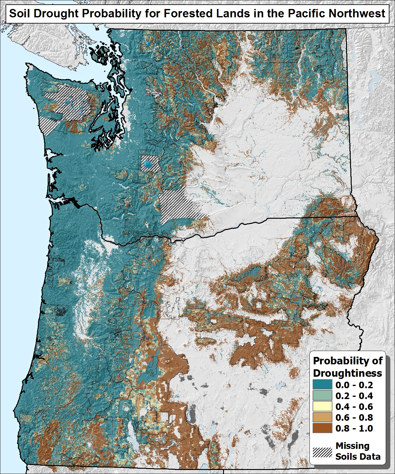
Modeled Soil Drought Probability for Forested Lands in the Pacific Northwest
Natural resource managers need better estimates of water storage and supply in forested landscapes, both in planning for management activities aimed at maintaining and enhancing forest health, and in preparing for a changing climate. In particular, low soil moisture in combination with high evaporative demands can induce significant stresses on forests, increasing vulnerability to attacks of insect and disease, as well as increasing wildfire risk. Although high-resolution soils data exist for much of the region, regional-scale datasets do not exist that identify forested areas on the landscape most vulnerable to soil moisture-related drought. This work was undertaken to help fill that need.
In this study we used readily-available spatial datasets depicting available water supply, soil depth, and evapotranspiration to model the likelihood that soils experience prolonged summer drying. To calibrate the model we examined soil profile descriptions, lab data, and soil moisture curves for 25 SNOTEL stations throughout the Pacific Northwest and estimated the average annual number of days that soil moisture drops to levels at or below permanent wilting point (PWP), the theoretical lower limit of plant-available water. Using this approach we found statistically significant relationships between the independent variables and broad classes of soil moisture levels representing the highest and lowest levels of plant-available moisture. The raster dataset presented here represents the probability that a given soil falls into the “droughty” class, defined in this study to be those for which soil moisture falls to levels at or below PWP for an average of at least 10 weeks annually.
We expect that this approach can be further developed to include additional SNOTEL data outside Washington and Oregon and other explanatory variables such as topographic position. The current dataset can aid in identifying vulnerable landscapes in the context of managing for increased forest resiliency.
R6_SoilDroughtProbability.gdb.zip