Climate Change and Forest Trees in the Pacific Northwest
A Vulnerability Assessment and Recommended Actions for National Forests
June 2012
Prepared by:
Warren Devine, Carol Aubry, Andrew Bower, Jeanne Miller, and Nicole Maggiulli Ahr
USDA Forest Service, Pacific Northwest Region
 Abstract
Climate change predictions for the U.S. Pacific Northwest include overall warming and potentially increased winter precipitation and decreased summer precipitation. Information on the potential impacts of these changes is essential to manage National Forest System lands for the future. The objective of this study is to assess the vulnerability of forest trees of Washington and Oregon to climate change and to propose practical management actions that will work under a variety of future climate scenarios and will conserve biodiversity and increase resiliency in Pacific Northwest national forests.
To order a CD or printed copy of the full report, the executive summary, or both, please use the Publication Request Form and email it to [email protected].
The report and supporting documents also can be downloaded using the links below.
Climate Change and Forest Trees in the Pacific Northwest: A Vulnerability Assessment and Recommended Actions for National Forests
- Report - Includes the regional report and appendices 1-6, which focus on each of the six subregional study areas; this document includes all executive summaries
- Executive Summary - Includes executive summaries of the regional report and those of appendices 1-6 (the six subregional study areas)
- Appendix 7: Tree Species Distribution Maps (not included in report) - Tree species distribution maps for all six subregional study areas.
- Appendix 8: Tree Species Profiles (not included in report) - For each Pacific Northwest tree species, biological and ecological information relevant to climate change is summarized in a 2-to-3 page entry.
Alternatively, the tree species distribution maps from appendix 7 can be downloaded separately for each subregional study area:
- Tree species distribution maps for subregion 1: Western Washington
- Tree species distribution maps for subregion 2: Northwestern Oregon
- Tree species distribution maps for subregion 3: Eastern Washington
- Tree species distribution maps for subregion 4: Eastern Oregon
- Tree species distribution maps for subregion 5: Central Oregon
- Tree species distribution maps for subregion 6: Southwestern Oregon
Additional documents
- Guide to Vulnerability Assessment Methods - This document provides a detailed description of our vulnerability assessment methodology. It is designed to assist users in applying our assessment approach to a different study area with different tree species.
- Vulnerability assessment spreadsheet model - This is our version of the ForGRAS model developed by Kevin Potter and Barbara Crane. This Excel spreadsheet model is blank, allowing users to enter their own data.
- Vulnerability assessment spreadsheet model with data - This version of the spreadsheet model includes the data that we used in our Pacific Northwest assessment; users can adjust parameters based on their own assumptions. There is a separate workbook for each subregion.
- Climate Change and Forest Biodiversity: A Vulnerability Assessment and Action Plan for National Forests in Western Washington (2011) - An earlier version of our western Washington vulnerability assessment. This report includes an assessment of non-forested habitats in western Washington that is not included in the 2012 report. It also includes some additional background information on our methodology.
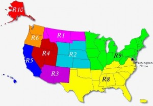
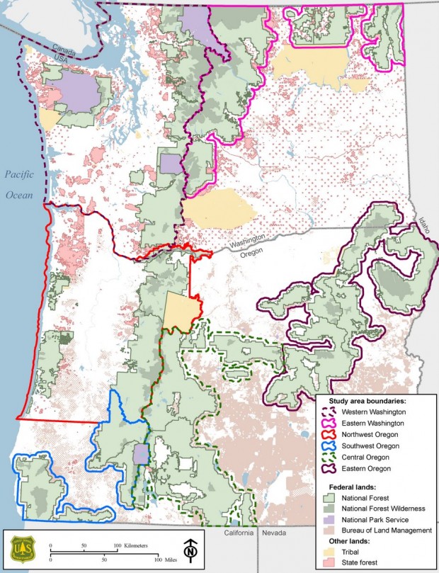
 This study took place in Forest Service Region 6 (R6), the Pacific Northwest Region, which consists of Washington and Oregon. We divided Region 6 into six subregional study areas with two to three national forests in each. This allowed us to focus on localized tree species and populations, and geographical and climate attributes.

